
As the introduction to the Principles Concerning Rural Landscapes as Heritage recognizes, these landscapes are a vital component of the heritage of humanity. While they are the most common type of continuing cultural landscapes, they are also some of the most diverse representing a wide variety of cultures and cultural tradition. For this reason, one of the important implementing actions in the World Landscape Principles is to better understand rural landscapes and their heritage values.
This article examines these foundational implementing actions with specific refence to two case studies in Australia:
| A. UNDERSTAND RURAL LANDSCAPES AND THEIR HERITAGE VALUES |
1 Recognise that all rural landscapes have heritage values. These values will vary with scale and character (shapes, materials, uses and functions, time periods, changes). They may then be assessed as having ordinary or outstanding values worthy of inclusion in national or World Heritage registers
2 Document the heritage values of rural landscapes.This is an essential requirement for effective planning, decision-making, and management. Inventories and catalogues from public agencies like Departments of Agriculture or Geological Survey departments, atlases and maps, all provide basic knowledge of rural landscapes for spatial planning, environmental and heritage protection and management tools, landscape design and monitoring.
3 Develop base-line knowledge of the physical and cultural characteristics of rural landscapes. The status of the rural landscape today; its historical transformations and expressions of tangible and intangible heritage; historic, inherited, and contemporary socio-cultural perceptions of the landscape; past and present links (spatial, cultural, social, productive, and functional) between all elements (natural and human-made, material and immaterial) of rural landscape systems; and the stakeholders involved in both their past and present. Inventorying and cataloguing aim to describe rural landscapes in the current state but also to identify changes over time.
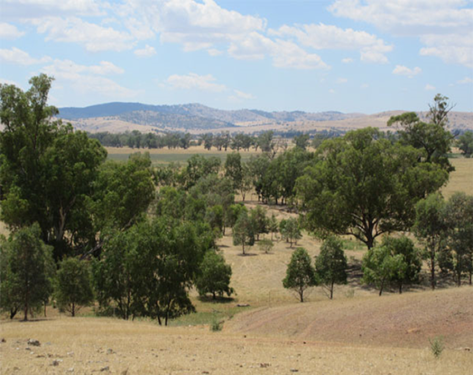
CASE STUDY: Cross Property Planning Project, Murrumbidgee region, New South Wales
The Cross Property Planning project has connected 74 landowners across 56,000 hectares in NSW’s central Murrumbidgee region in a bid to implement more sustainable land practices. The six-year project evaluated biodiversity attributes across each property to come up with a tailor-made plan for every farm.
Enlisting all 74 landowners to implement more sustainable land practices was challenging because the project needed to work across fence lines to preserve and link scattered native vegetation and the properties varied in size, land condition, and management. The Project partnered with 25 organisations to deliver workshops and field days on landholder properties (over 60 attended by 1,100 landholders) demonstrating techniques such as pasture cropping, low-cost erosion control, low-input pasture management, paddock subdivision and weed containment via native species. Plans were drawn up based on each property’s needs, with incentive funding provided to put them into practice.
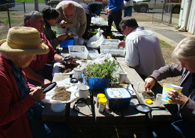
So far 1,761 hectares of farmland has been fenced for the protection of native vegetation, with more than 86,000 native seedlings planted. Dams and other waterways have been fenced to control livestock access, reducing erosion and enhancing water quality. Integrated weed management and coordinated pest management has taken place, while revegetation around gullies has sought to prevent dryland salinity impacts. Remnant vegetation on properties, including scattered mature trees, has also been protected
The participants acknowledged the Indigenous history manifested in artefact scatters along creeks, scar trees and in place names. They also examined the extent of colonial clearing of the original vegetation, fire and flood histories, and previous attempts by some farmers to stabilise soils and limit stocking numbers.This Murrumbidgee Landcare group are proud of their cooperative efforts. In 2018 they were won the Australian Government Excellence in Sustainable Farm Practices Award
4 Inventory and catalogue rural landscapes at all scales (world, regional, national, local).These cataloguing tools should integrate local, traditional and scientific knowledge and use systematic methods that are readily achievable and suitable for use by both specialists and non-specialists in all countries in order to collect and compare rural landscapes internationally and locally. In order to achieve an effective database, inventorying and cataloguing activities should consider complexity, costs of human resources, timing of data collection and organisation, and involve both experts and local inhabitants. The community of farmers who cooperated to map and plan conservation actions on their farms were described in the previous article.
5 Develop knowledge to enable comparison of rural landscapes at all levels (world, regional, national, local) It is important to monitor historical changes to rural landscapes and support shared learning and collaboration from local to global scales and among all public and private stakeholders.
6 Recognize local populations as knowledge-holders. These are the people who in many cases help to shape and maintain the landscape and should be involved to the building of collective knowledge.
7 Promote extensive and ongoing cooperation among public institutions, non-governmental organizations, and universities. Identifying partners for research, information sharing, technical assistance, and coordination of a wide variety of knowledge building activities at all administrative levels.
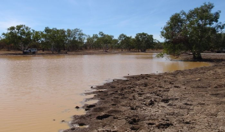
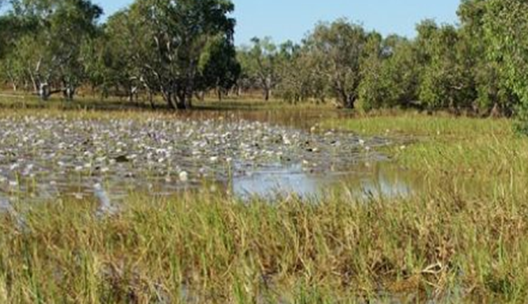
CASE STUDY: Namaliwiri billabong, Ngukurr, Roper River, Northern Territory
The Ngandi swam among the water lilies in billabongs, collecting bush food and bush medicine and having ceremonies nearby. Over 70 years the landscape was transformed by cane toads, rubbish, pests, weeds, and tree felling. In 2002, Cherry Daniels established a women’s ranger group to help restore the land. Cherry says billabongs are like “supermarkets” for her people —full of plants and animals that can be eaten, or made into useful things: water lilies, sedges and grasses, paperbarks, sweet and bitter yams, fish, freshwater turtles, crabs, mussels, Magpie geese and goannas.
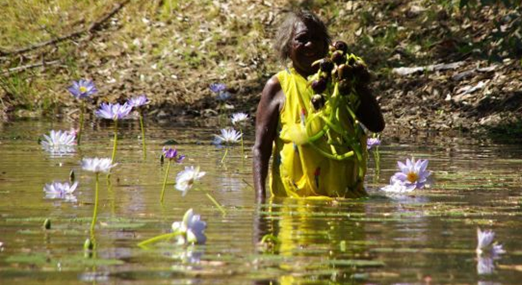
Today, the Yugul Mangi rangers consisting of 20 men and women from several different Aboriginal groups care for a combined 20,000 square kilometres of their lands around Ngukurr (Salleh 2016). Greening Australia Inc funded fencing off billabongs to stop feral pigs, horses and buffaloes from trampling the surrounding ground, muddying the waters and eating prized water lilies. Together with Macquarie University scientist Dr Emilie Ens, the rangers studied fenced billabong areas, comparing them to unfenced areas. Two of the billabongs in the fencing study are part of a songline on Cherry’s country and of deep cultural significance (Ems et al. 2016). The study showed that four years of fencing saw an increase in lily cover at Namaliwiri billabong from 10 to 60 per cent. Good water lily cover is a measure of success from both a western scientific and Indigenous perspective.
More than a third of Australia is recognized as Aboriginal owned and managed land and Indigenous people living on these lands have a key role in conservation. Over the years the Yugul Mangi Rangers have worked with, and received funding from, many sources including:
- The Atlas of Living Australia
- The Nature Conservancy
- Greening Australia
- Landcare
- The Federal Government’s Working on Country Indigenous Ranger program.
- Macquarie University
- Australian National University
- CSIRO
- AQIS
References:
Emms, E.J., C. Daniels, E.Nelson, J.Roy, P.Dixon, 2016. Creating multi-functional landscapes: Using exclusion fences to frame feral ungulate management preferences in remote Aboriginal-owned northern Australia, Biological Conservation, 147 (May): 235-246.
Salleh, Anna, 2016. “Way of the water lilies: Where science meets the billabong.h
Jane Lennon
October 2019