WORLD RURAL LANDSCAPES: A Worldwide Initiative for Global Conservation and Management
What are the best ways to identify and conserve rural landscapes? Since 2012, participants at a series of international meetings have sought to answer this complex question, in part through the development of a new set of shared general principles.
The initiative is being led by the International Scientific Committee on Cultural Landscapes (ISCCL). The ISCCL was established in 1971 by the International Council on Monuments and Sites (ICOMOS) in partnership with the International Federation of Landscape Architects (IFLA) as a joint expert committee. The committee promotes world-wide cooperation in the identification, study, and management of cultural landscapes. It also offers training and educational programs.
The text for the Principles for World Rural Landscapes was finally endorsed and adopted, as a doctrinal text, by ICOMOS at its 19th ICOMOS General Assembly & Symposium, Delhi, India, 11th-15th December 2017. The IFLA World Council adopted the Document on 20th October 2017 in Montreal (Canada).
Since the ratification of the Principles, the World Rural Landscape group has been active disseminating the Principles Text and developing related activities such as an atlas of world rural landscapes, a glossary, and bibliography. In particular the group has developed:
- A Chinese translation of the Principles’ Text
- A Spanish translation prepared for ISCCL Mendoza meeting in December 2018
- Introduction of the World Rural Landscapes Initiative and rural landscape issues in other symposiums, for examples at the “Nature–Culture Journey” (Hawaii 2017, San Francisco 2018)
- Support for ICOMOS in the organization of the Symposium on Rural Landscapes for the Morocco – Marrakech ICOMOS Assembly, October 2019 and ISCCL Annual Meeting in Dublin, June 2019.
This article in the Living Landscape Observer (2024) is based upon a series of short articles (2019-2020) illustrating each of the Principles on World Rural Landscapes with real world examples and case studies primarily from Australia. Key elements of which include: a definition of terms, identification of challenges, exploration of threats, and discussion of benefits related to rural landscape conservation. The Principles also outline a plan of action for not only protection, but also dissemination of knowledge surrounding best practice. Many thanks to Jane Lennon of Australia ICOMOS for leading this effort. Please read more about Dr. Lennon at the end of this article.
WORLD RURAL LANDSCAPES PRINCIPLES: Threats, challenges, benefits, and sustainability
The ‘Principles Concerning Rural Landscapes as Heritage’ (ICOMOS 2017)1 after defining rural landscapes also briefly develop themes relating to threats, challenges, benefits, and sustainability for rural landscapes from a cultural heritage point of view for today’s society. These challenges have been examined by scholars, scientific and cultural associations and public administrations, both at international and local levels and you will probably be aware of many of these issues
Importance of rural landscapes
‘Rural landscapes have been shaped over millennia and represent significant parts of the earth’s human and environmental history, ways of living, and heritage… The diversity of agricultural, forest, animal husbandry, fishery and aquaculture, wild-resource, and other resource practices is essential for the future adaptation and resilience of global human life.’ These multifunctional resources have socio-cultural values giving a strategic character
to the rural landscape. Heritage values can be present in all rural areas ‘both outstanding and ordinary, traditional and recently transformed by modernisation activities’ while, depending on the location, ‘heritage can be present in different types and degrees and related to many historic periods, as a palimpsest.’ Awareness of these identified values is a necessary step in promoting the sustainable conservation of such rural landscapes and transmission of their associated knowledge and cultural meanings to future generations.
Threats
Rural landscapes in many parts of the world are undergoing radical transformation. ‘Increasing human populations and climate change make rural landscapes vulnerable to risks of loss and/or abandonment or radical change. The threats to rural landscapes reflect three inter-related types of change:
- Demographic and cultural (population growth in urban areas and depopulation in rural areas, urban expansion, intensive infrastructure works, development pressures, loss of traditional practices, techniques, local knowledge, and cultures.)
- Structural (globalization, change and growth of trade and relations, economic growth or decline, intensification of agricultural practices and techniques, change of land and loss of native pastures and of domesticated species diversity);
- Environmental (climate change, pollution and environmental degradation including non- sustainable resource mining, impacts on soil, vegetation, and air quality, and loss of biodiversity and agro-biodiversity).’
Challenges
‘Heritage should play a significant role in the recognition, protection and promotion of rural landscapes and biocultural diversity due to the significant values it represents.’
To conserve the integrity and authenticity of heritage requires focus on assuring the standard and quality of living of local populations working and living there. Rural heritage is an economic resource and its use should reflect traditional methods while providing vital support for its long-term sustainability.
Benefits
‘Rural landscapes are critical resources for the future of human society and the world environment’. In addition to food and raw materials, rural landscapes contribute to land conservation and the transmission of rural cultures to future generations. Rural landscapes often provide distinct economic and tourism benefits when closely associated with the communication and enhancement of their heritage values. Communities as knowledge-holders, or local initiatives and collaboration among stakeholders, rural and urban inhabitants, and professionals have contributed to conservation, awareness, and enhancement of rural landscapes as a valuable shared resource.
Sustainability
‘Many rural systems have proven to be sustainable and resilient over time. Various aspects of these systems can inform future management of rural activities and support conservation and improvement of biocultural diversity and peoples’ rights to adequate quantities and good quality of food and raw materials.’
Landscapes are in continuous natural evolution and often inevitable processes of transformation thanks to their links to farming practices and farmers’ ways of life. ‘Rural landscape policies should focus on managing acceptable and appropriate changes over time, dealing with conserving, respecting, and enhancing heritage values.’ What changes are appropriate will be the subject of future articles in LLO. These articles will discuss in detail the criteria that will inspire action.
- All quotations in italics in this article are from the Principles Concerning Rural Landscapes as Heritage’ (ICOMOS 2017) ↩︎
WORLD RURAL LANDSCAPE PRINCIPLES: Understand Rural Landscapes and Their Heritage Values
As the introduction to the Principles Concerning Rural Landscapes as Heritage recognizes, these landscapes are a vital component of the heritage of humanity. While they are the most common type of continuing cultural landscapes, they are also some of the most diverse representing a wide variety of cultures and cultural tradition. For this reason, one of the important implementing actions in the World Landscape Principles is to better understand rural landscapes and their heritage values.
This article examines these foundational implementing actions with specific reference to two case studies in Australia:
A. UNDERSTAND RURAL LANDSCAPES AND THEIR HERITAGE VALUES
- Recognise that all rural landscapes have heritage values. These values will vary with scale and character (shapes, materials, uses and functions, time periods, changes). They may then be assessed as having ordinary or outstanding values worthy of inclusion in national or World Heritage registers.
- Document the heritage values of rural landscapes. This is an essential requirement for effective planning, decision-making, and management. Inventories and catalogues from public agencies like Departments of Agriculture or Geological Survey departments, atlases and maps, all provide basic knowledge of rural landscapes for spatial planning, environmental and heritage protection and management tools, landscape design and monitoring.
- Develop base-line knowledge of the physical and cultural characteristics of rural landscapes. The status of the rural landscape today; its historical transformations and expressions of tangible and intangible heritage; historic, inherited, and contemporary socio- cultural perceptions of the landscape; past and present links (spatial, cultural, social, productive, and functional) between all elements (natural and human-made, material and immaterial) of rural landscape systems; and the stakeholders involved in both their past and present. Inventorying and cataloguing aim to describe rural landscapes in the current state but also to identify changes over time.
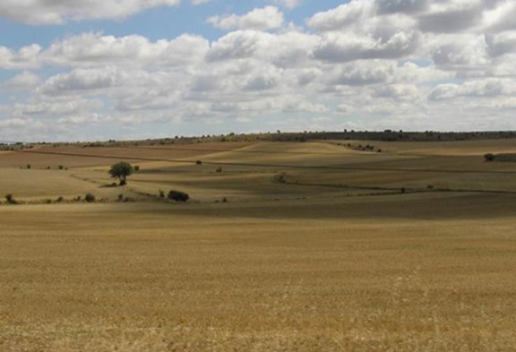
CASE STUDY: Cross Property Planning Project, Murrumbidgee region, New South Wales
The Cross Property Planning project has connected 74 landowners across 56,000 hectares in NSW’s central Murrumbidgee region in a bid to implement more sustainable land practices. The six-year project evaluated biodiversity attributes across each property to come up with a tailor-made plan for every farm.
Enlisting all 74 landowners to implement more sustainable land practices was challenging because the project needed to work across fence lines to preserve and link scattered native vegetation and the properties varied in size, land condition, and management.
The Project partnered with 25 organisations to deliver workshops and field days on landholder properties (over 60 attended by 1,100 landholders) demonstrating techniques such as pasture cropping, low-cost erosion control, low-input pasture management, paddock
subdivision and weed containment via native species. Plans were drawn up based on each property’s needs, with incentive funding provided to put them into practice.
So far 1,761 hectares of farmland has been fenced for the protection of native vegetation, with more than 86,000 native seedlings planted. Dams and other waterways have been fenced to control livestock access, reducing erosion and enhancing water quality. Integrated weed management and coordinated pest management has taken place, while revegetation around gullies has sought to prevent dryland salinity impacts. Remnant vegetation on properties, including scattered mature trees, has also been protected.
The participants acknowledged the Indigenous history manifested in artefact scatters along creeks, scar trees and in place names. They also examined the extent of colonial clearing of the original vegetation, fire and flood histories, and previous attempts by some farmers to stabilise soils and limit stocking numbers. This Murrumbidgee Landcare group are proud of their cooperative efforts. In 2018 they were won the Australian Government Excellence in Sustainable Farm Practices Award.
- Inventory and catalogue rural landscapes at all scales (world, regional, national, local). These cataloguing tools should integrate local, traditional and scientific knowledge and use systematic methods that are readily achievable and suitable for use by both specialists and non-specialists in all countries in order to collect and compare rural landscapes internationally and locally. In order to achieve an effective database, inventorying and cataloguing activities should consider complexity, costs of human resources, timing of data collection and organisation, and involve both experts and local inhabitants. The community of farmers who cooperated to map and plan conservation actions on their farms were described in the previous article.
- Develop knowledge to enable comparison of rural landscapes at all levels (world, regional, national, local) It is important to monitor historical changes to rural landscapes and support shared learning and collaboration from local to global scales and among all public and private stakeholders.
- Recognize local populations as knowledge-holders. These are the people who in many cases help to shape and maintain the landscape and should be involved to the building of collective knowledge.
- Promote extensive and ongoing cooperation among public institutions, non- governmental organizations, and universities. Identifying partners for research, information sharing, technical assistance, and coordination of a wide variety of knowledge building activities at all administrative levels.
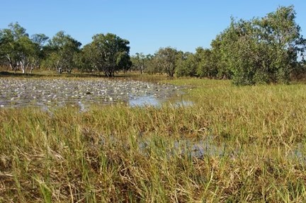
CASE STUDY: Namaliwiri billabong, Ngukurr, Roper River, Northern Territory
The Ngandi swam among the water lilies in billabongs, collecting bush food and bush medicine and having ceremonies nearby. Over 70 years the landscape was transformed by cane toads, rubbish, pests, weeds, and tree felling. In 2002, Cherry Daniels established a women’s ranger group to help restore the land. Cherry says billabongs are like “supermarkets” for her people —full of plants and animals that can be eaten, or made into useful things: water lilies, sedges and grasses, paperbarks, sweet and bitter yams, fish, freshwater turtles, crabs, mussels, Magpie geese and goannas.
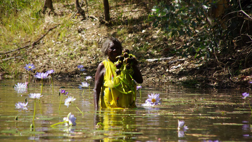
Today, the Yugul Mangi rangers consisting of 20 men and women from several different Aboriginal groups care for a combined 20,000 square kilometres of their lands around Ngukurr (Salleh 2016). Greening Australia Inc funded fencing off billabongs to stop feral pigs, horses and buffaloes from trampling the surrounding ground, muddying the waters and eating prized water lilies. Together with Macquarie University scientist Dr Emilie Ens, the rangers studied fenced billabong areas, comparing them to unfenced areas. Two of the billabongs in the fencing study are part of a songline on Cherry’s country and of deep cultural significance (Ems et al. 2016). The study showed that four years of fencing saw an increase in lily cover at Namaliwiri billabong from 10 to 60 per cent. Good water lily cover is a measure of success from both a western scientific and Indigenous perspective.
More than a third of Australia is recognized as Aboriginal owned and managed land and Indigenous people living on these lands have a key role in conservation. Over the years the Yugul Mangi Rangers have worked with, and received funding from, many sources including:
- The Atlas of Living Australia
- The Nature Conservancy
- Greening Australia
- Landcare
- The Federal Government’s Working on Country Indigenous Ranger program.
- Macquarie University
- Australian National University
- CSIRO
- AQIS
References:
Emms, E.J., C. Daniels, E.Nelson, J.Roy, P.Dixon, 2016. Creating multi-functional landscapes: Using exclusion fences to frame feral ungulate management preferences in remote Aboriginal-owned northern Australia, Biological Conservation, 147 (May): 235-23
Salleh, Anna, 2016. “Way of the water lilies: Where science meets the billabong.”
WORLD RURAL LANDSCAPES PRINCIPLES: Protect Rural Landscapes and Their Heritage Values
Legal protection and policy frameworks are needed to protect the heritage values of rural landscapes. In Australia this protection varies.
Public lands like national parks and conservation reserves are usually managed through their own legislation which sets out the management objectives and values that must be protected. Privately owned rural lands might be zoned rural, rural residential or conservation in local government planning schemes and this entails a range of policies enabling uses. ‘Rural zone’ land has the least constraints and is generally farming land – agriculture, horticulture, grazing, cropping. However, the suite of policies varies in different regions and States.
B1. Legal and policy frameworks
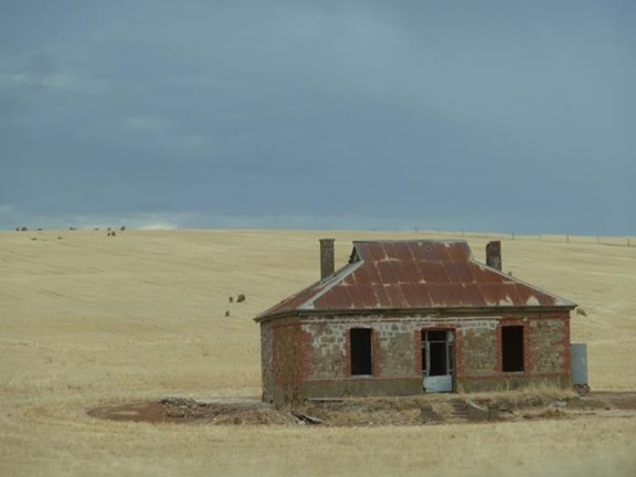
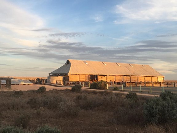
Windmills, fences, homesteads, shearing sheds, bores, stock yards, travelling stock routes, bush roads and railheads all changed the appearance of the original country. These historic features form an important part of our rural heritage but are not readily discernible to those without social connections to the countryside. Some of the iconic homesteads and woolsheds are listed on State government heritage registers and legally protected. Most of Australia’s rural heritage which is protected is designed colonial farms and estates, where before 1850 many convicts cleared trees, built fences and yards, and many are now relict landscape features. The associated agricultural landscapes are not protected under heritage controls as they continue to evolve as productive farms. Each State and the Commonwealth maintain heritage registers developed since 1974 in response to the growing recognition of the value of heritage to the community.
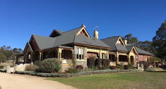
Left: Lake Mungo woodshed 2017 (J. Lennon), Right: Waterloo Station Homestead, Matheson via Glen Innes NSW (J. Lennon May 2017)
States have the power in the Australian Constitution to regulate land use and heritage listed places are protected through provisions of the local government planning schemes. Some States have Local Environment Plans (LEPs) with Heritage Overlays which identify heritage items, mostly buildings, and aim to protect the visual character of distinctive farming areas. The rural zoning in the LEPs aims to encourage sustainable primary industry production by maintaining and enhancing the natural resource base, while minimising the fragmentation and alienation of resource lands and conflicts between land uses within the zone and land uses within adjoining zones. There is rural landscape zoning which aims to maintain the rural landscape character of the land, providing for a range of compatible land uses, including extensive agriculture, while encouraging the retention, management or restoration of native vegetation. There are strict laws to protect native vegetation which has caused conflict with farmers wanting to clear mature regrowth.
The Environment Protection and Biodiversity Conservation Act 1999 (EPBC Act) is the Australian Government’s environmental legislation. It covers environmental assessment and approvals, protects significant biodiversity and integrates the management of important natural and cultural places.If a new project on rural land is likely to have a significant impact on a matter of National Environmental Significance(such as a threatened native grassland, marine park or threatened species), the matter is referred to the Australian Government Department of Climate Change, Energy, the Environment and Water.
B 2. Implement policies
In November 2019, Australian Environment Ministers endorsed a new approach to biodiversity conservation through Australia’s Strategy for Nature 2019-2030. The Strategy is supported by a dedicated website, Australia’s Nature Hub. They bring together existing work across the country to guide the development of new and innovative approaches to biodiversity conservation. The Strategy goals support healthy and functioning biological systems by promoting a stronger connection between people and nature, improving the way we care for nature, and building and sharing knowledge. It provides an adaptive approach allowing each jurisdiction the flexibility to establish targets appropriate to the variety of environments across Australia and to change these as knowledge is built during the life of the strategy.
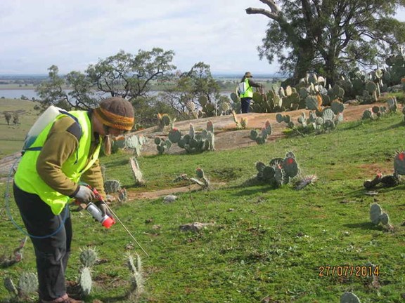
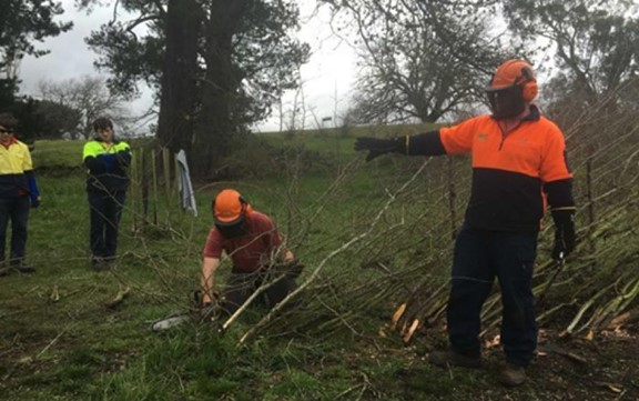
Eradication of pest plants and animals in the rural landscape requires many partners. This case study shows one group at work:
The Tarrangower Cactus Control Group was formed in 2005 specifically to tackle the infestations of Wheel Cactus (Opuntia robusta) invading our rural landscapes. It is a well organised group of volunteers and landowners dedicated to destroying and controlling these infestations of Wheel Cactus on private and public land. This noxious weed is now a Weed of National Significance because it is extremely invasive and difficult to kill. The group encourages participation by demonstrating best-practice management and providing incentives. They hold several community field days each year and produce and distribute information brochures and media releases.
Policies to protect biodiversity in rural landscapes of all scales are being implemented by private groups as well as government nature conservation agencies.
Another case study revolves around volunteer conservation works: BirdLife Australia’s Gluepot Reserve is Australia’s largest community managed and operated conservation reserve. It is located in South Australia’s Riverland, and managed and operated entirely by volunteers. Some 54,000 hectares in size, it is home to 22 nationally threatened species of birds, 53 species of reptiles and 12 species of bats, some of which are nationally threatened. Volunteers conduct many programs including feral control, bird counts and environmental education courses.
B 3. Define strategies and actions of dynamic conservation, repair, innovation, adaptive transformation, maintenance, and long-term management
The Landcare approach supports farmers and pastoralists in developing robust and resilient businesses incorporating sustainable food and fibre production and natural resource conservation. It also supports engagement and participation of Aboriginal and Torres Strait Islander communities in Indigenous land management, people involved in sustainable resource management on public and private land and activities by young people through educational institutions.
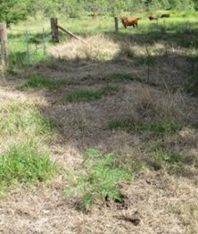
The following case study is typical of many involving small holders along waterways. The project involved restoring degraded creek banks on a small holding following overgrazing and clearing along Bottle Creek, a tributary of the Clarence River in northern NSW. A small grant of $14,000 for materials and tube stock with planting by volunteer labour was used to restore the degraded or missing riparian vegetation The restoration process involved obtaining Landcare funding to fence out grazing stock; collecting and germinating native plant seed, planting tube stock into ground sprayed to eradicate grass and controlling grass as the plants grew. The result was mature trees in three years, reintroducing river side native vegetation which has increased habitat for birds and enabled connectivity to forested higher ridges.
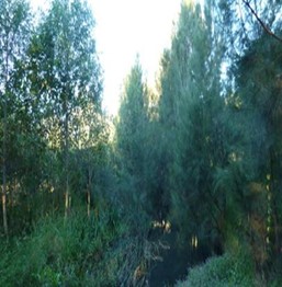
Bottle Creek restoration, 2015 (Photos: J. Lennon)
WORLD RURAL LANDSCAPES PRINCIPLES C: Sustainably Manage Rural Landscapes and Their Heritage Values
There is a need to sustainably manage rural landscapes and their heritage values. In Australia sustainable management has usually referred to private lands and one of the driving forces in this management has been through Landcare for the last 30 years. This has also spawned other groups practising organic, biodynamic and regenerative farming. At the national level, there is no sustainable agriculture policy despite two decades of a fragmented, stop-start approach. Australia’s only substantial sustainable agriculture policy mechanism seems to be grants available through the National Landcare Program which are around A$1 billion from 2017 to 2023. And even though these grants are substantial, past Australian Bureau of Statistics surveys found that farmers invest at least A$3 billion a year in natural resource management. Around 10% of Australia’s population lives in rural or remote areas. These comparatively small communities – largely farmers and Indigenous land managers – currently steward most of the country. The following case studies illustrate their work in terms of the application of World Rural landscape principles.
C 1. Consider bio-cultural rights within food and natural resource production. Implement planned management approaches that acknowledge the dynamic, living nature of landscapes and respect human and non-human species living within them.
Case Study: Spinifex Lands
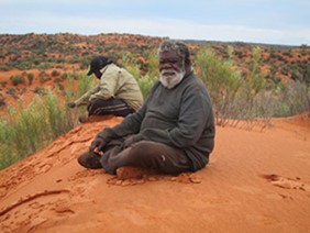
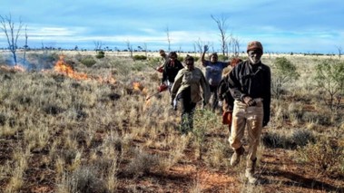
Left: Byron Brooks and Troy Hansen, ranger, on the sand dune at Miramiratjara (Spinifex Country) during the third Healthy Country Planning on-country trip (August 2015). Photo courtesy of Pila Nguru. Right: Spinifex Land Management cultural adviser, Byron Brookes leads the rangers at a buffel grass burn near Tjuntjuntjara, August 2017. Photo: Samantha Doudle / Spinifex Land Management
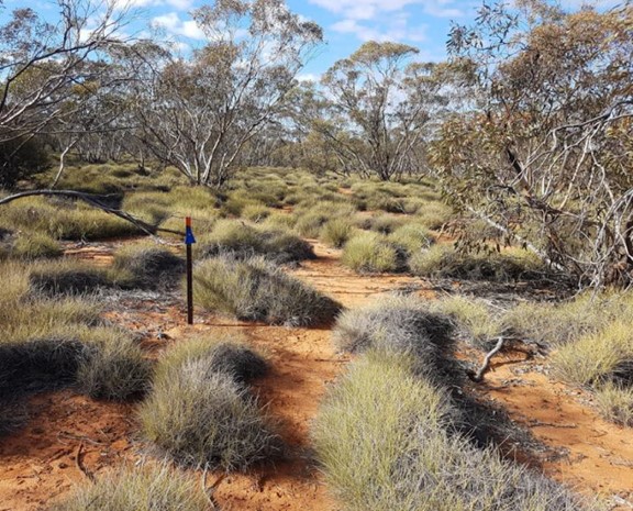
The Anangu Pila Nguru (Spinifex People) are using a combination of traditional and contemporary land management practices to reduce threats and keep the people, culture and land healthy. The land area ranges from the Nullarbor Plain to the south, spinifex and sandhill country to the north and a variety of land forms incorporating salt lakes, rocky outcrops, hills, valleys and open plains with a wide range of desert marsupials, birds, plants and insects. A Healthy Country Plan developed by local rangers and the community provide direction and technical support. A standard Land Access and Mineral Exploration Agreement was the template developed to protect areas of cultural significance.
The Spinifex Land Management Program is based in Tjuntjuntjara, the second most remote community in Australia. The Healthy Country Plan covering 95,000 square kilometres has key projects including reducing the threats of buffel grass, camels, altered fire regimes, and introduced predators. They aim for total eradication of buffel grass from their lands within 10 years. Buffel grass (Cenchrus ciliaris) is widely recognised as the single greatest invasive species threat to biodiversity across the entire Australian arid zone as it is a “transformer species” that alters natural environments. It out-competes native plants, increases fire intensity, degrades native wildlife habitat and can outcompete bush tucker food plants for Indigenous people. Whereas traditional Aboriginal patch-burning encouraged regrowth of native grass species, the intense heat produced by burning buffel grass destroys native plants both above and below ground. Aboriginal women are reluctant to undertake traditional gathering practices because thick buffel grass decreases visibility of snakes. This community won the 2017 Western Australian Indigenous Landcare Award for following both traditional Pila Nguru Anangu (Spinifex people) land care practices and fresh responses to new environmental threats.
C 3. Consider the connections between cultural, natural, economic, and social aspects across large and small landscapes, in the development of sustainable management strategies for rural landscapes as heritage resource.
Case Study: Reviving hedge laying, Tasmania
The original hedge fences planted by convicts in the 1820s-30s around farming land in the early colony fell into disrepair 60 or 70 years ago. Growing hedges as living fences was the latest agricultural innovation in England in the 1820s and came to Australia with the first settlers. They were using local plants like the prickly mimosa which grows on some of the hills but it was not suitable for hedging so imported hawthorn [Cretagus spp.) which grew particularly well in Tasmania.
The Dumaresq family, sixth generation farmers, have employed James Boxhall, one of Australia’s few traditional hedge layers to trim the hedges again, lay them over in the traditional way and bring them back into traditional working order over ten years. The satisfaction of preserving these ancient hedges and passing on a dying craft has kept people like Mr Boxhall on the job, cutting, pushing, bending and chainsawing the thorny and at times nasty plants back into the shape of the traditional fences. Twenty-first century hedge laying involves a mix of traditional and modern skills using the ancient cutting tool, the billhook, and the modern chainsaw, which allow the hedge layers to get through a restoration more quickly than their forebears. It is an expensive, long term, 10 year plan for the Dumaresqs.
Only 3,000 kilometres of historic hawthorn hedges remain. Encouraging people to have their hedges laid instead of pulling them out leads to restoration of a beautiful thick hedge adding value to a property. Some farmers see them as a hindrance to modern larger fields and conservationists see them as exotic plants harbouring feral fauna. Hedges are an important aesthetic component of the Tasmanian cultural landscape of farm lands and not protected by legislation so appealing to owners to look after them is necessary .
C 6. Support the equitable governance of rural landscapes, including and encouraging the active engagement of local populations, stakeholders, and rural and urban inhabitants, in both the knowledge of, and responsibilities for, the management and monitoring of rural landscapes heritage. Because many rural landscapes are a mosaic of private, corporate, and government ownership, collaborative working relationships are necessary.
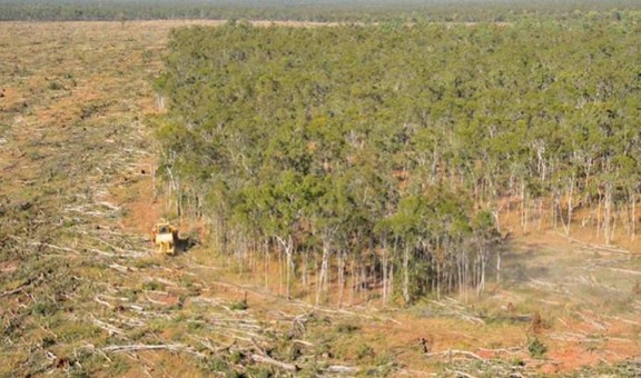
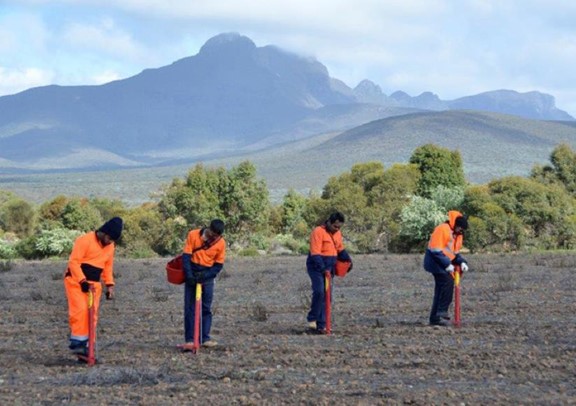
Case Study: Gondwana Link, WA
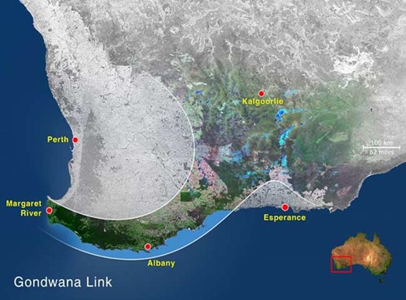
To achieve a band of healthy, reconnected bush across south-western Australia, one of the world’s 25 biodiversity hotspots, Gondwana Link aims to create 1,000 km of continuous habitat from the dry woodlands of the interior to the tall wet forests of the far south-west corner. Two-thirds of the vegetation had been cleared but within 900 kms patches of the original habitat is relatively intact, making the gaps of cleared land the key restoration focus. Now entering its 18 th year, Gondwana Link is an inspiring example of a cohesive effort by a broad spectrum of local, regional, national and international groups, private landholders and Indigenous communities. This is landscape repair at a mega-scale. To restore habitat and heal country in the Gondwana Link, Greening Australia is working with Nowanup Rangers on a unique eco-cultural project. Under the shadow of the Stirling Ranges National Park mountains, tree planting is incorporating traditional designs of Noongar culture. This eco-cultural restoration approach recognises the age-old connection between the Indigenous community, plants and animals, and the landscape reconnecting habitat so wildlife can move between the region’s national parks, across the wheatlands and sheep farms and help ensure the survival of endangered species such as the Carnaby’s Black Cockatoo.
WORLD RURAL LANDSCAPES PRINCIPLES: Communicating and Transmitting the Heritage and Values of Rural Landscapes
Finally, it is essential to communicate with the general public about the principles showing how heritage values in rural landscapes have been identified and protected through collaborative planning, research and action on the ground with all the stakeholders involved.
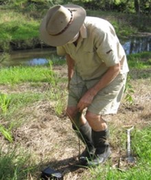
Transmitting historical information through archival, academic and local history research is a basis together with scientific studies by many disciplines and informed, observant local knowledge. State government departments of agriculture are working with farmers and academics to test new methods of using the land from soil moisture measurements to new varieties of cops to withstand the drying climate effects. Field days and country radio provide much information and meetings of like-minded farmers sharing information are key events on rural social calendars.
D 1. Communicate awareness of the heritage values of rural landscapes through collaborative participatory actions, such as shared learning, education, capacity building, heritage interpretation and research activities…that involve civil society, private organizations, public authorities, and amongst both urban and rural inhabitants.
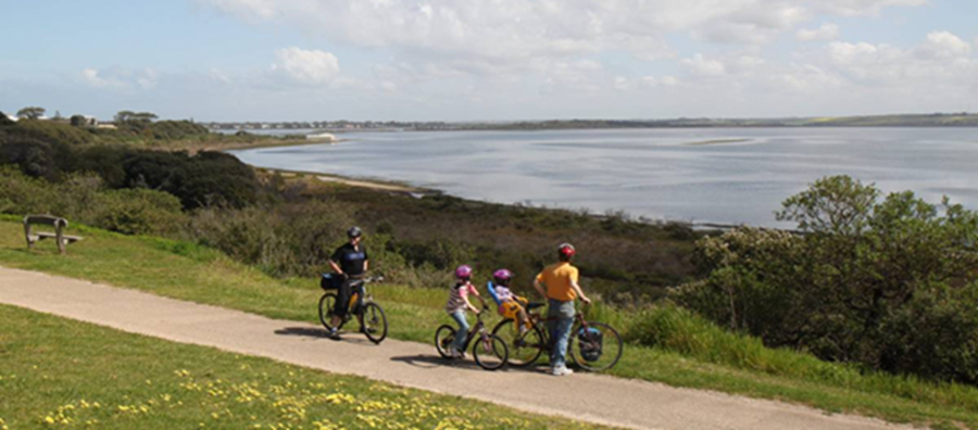
Case Study: Bellarine Rail Trail
The Bellarine Rail Trail in Victoria contains patches of remnant vegetation with rare flora species, but that diversity is under threat from weed invasion. With over 5,000 kms of rail corridors across Victoria, VicTrack supports Landcare to maximize their on-ground conservation activity by sponsoring Landcare’s Grassroots Program, which protects and restores native grasslands in and around the railway corridors. Many of these corridors are unused now and have heritage values. A partnership between Bellarine Catchment Network, VicTrack and Landcare is removing weeds allowing the natural regeneration of native species. Community and school engagement have been a key to the success of this project replanting degraded areas with native species including seedlings from the endangered vegetation community ‘Coastal Moonah Woodland.’ (https://landcareaustralia.org.au/news/bellarine-rail-trail-corridor-biodiversity/).
D 3. Support shared learning, training, and research using diverse tools, approaches and cultural practices… involving stakeholders, such as local communities, heritage specialists, professionals of various disciplines, schools and universities, and the media.
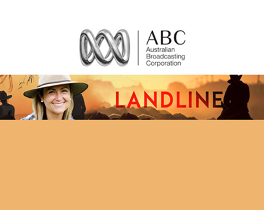
Landcare has been an enthusiastic promoter of field days to apply practically research as shown in many of the above case studies. Tree planting techniques are taught on site especially on community days involving people of all ages and backgrounds. Australian national television has a high rating weekly program called Landline. Each State has a weekly rural newspaper covering weather conditions, events, sales, and applied research into animal husbandry, cropping, soil protection, new techniques and applications. There is no shortage of academic and popular information, but the challenge is changing habits and mindsets about the compatibility of farming and conservation in a rapidly changing world of climate variability, fuel sources, market prospects, new crops and a social licence to farm.
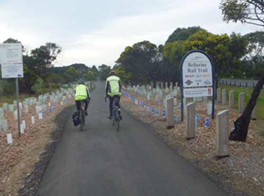
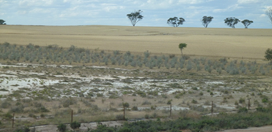
Left: Community tree planting along the Bellarine Rail Trail, Right: Salt degraded land in the Western Australian wheat belt
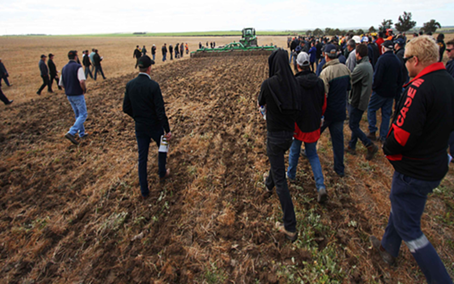
Field day in Western Australia demonstrating new soil protection techniques.
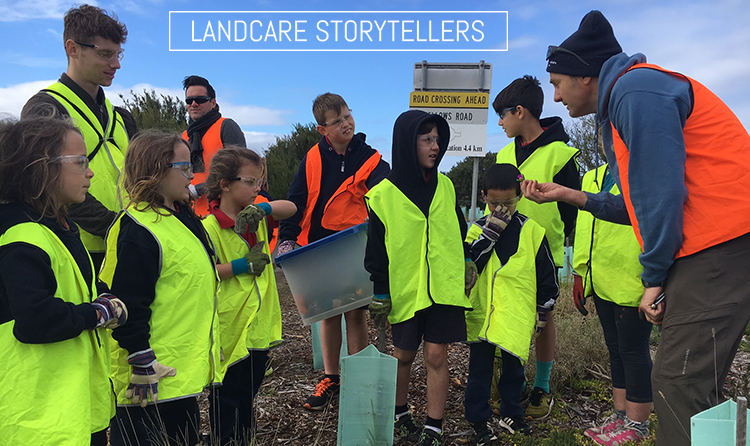
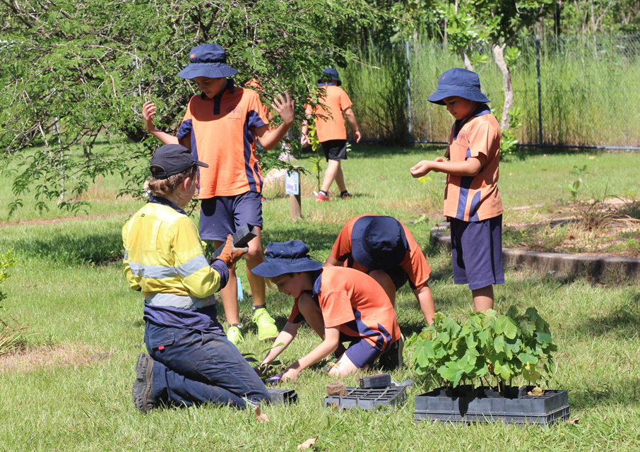
Bring Back the Bush! with the 500 Schools Planting Program
Jane Lennon is an historical geographer with a PhD on cultural landscape conservation; she is a founding member of Australia ICOMOS, and has published extensively. She has long experience in national park, museum, historic site management, heritage boards including the Australian Heritage Council, ICCROM and the ICOMOS/IFLA International Scientific Committee on cultural landscapes and has been an adjunct professor at Deakin University and honorary professor at the University of Melbourne specializing in heritage landscapes.