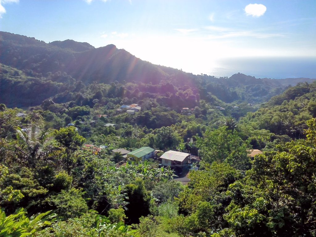
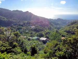
Gently swaying coconut palms. Crystal-clear turquoise waters. White sand beaches. We all know the idyllic landscape images of the Caribbean endlessly promoted in TV commercials for cruises and resorts. And there’s another, wilder Caribbean landscape familiar to eco-tourists: the nature reserves and National Parks that have been established throughout the region to protect against development and preserve distinctive local biomes.
Yet the landscape perceptions of many of the region’s residents do not mesh easily with the others. When asked about the significance of the protected landscapes and national parks of his own country, a respondent from Antigua and Barbuda told us that local residents do not see them as a part of their own cultural and natural heritage. They see them mainly as tourist attractions, serving cruise ship tourists and yachties. So if the protected landscapes were not theirs, why and for whom were they being protected? And how could the landscape perceptions of local residents be understood?
For the past eight years, my colleagues, Gustavo Araoz and Angela Labrador, and I coordinated a regional heritage project for the Organization of American States in thirteen English-speaking nations in the Caribbean. The main goal of the project was to promote community identification with heritage of all kinds—including the sites and landscapes that lay beyond the officially-recognized tourist routes. But a question that challenged us early in the project related to community values. How could we identify the elements that distinguished the day-to-day sense of place of local communities from that of international visitors—and from the images of the Caribbean reflected in vacation ads on TV? How could we elicit the sense of place privately held by local residents?
I have to admit that I’m far from an expert in cultural landscapes or landscape values. My professional experience has always been in site interpretation, usually along the carefully demarcated paths of individual sites. Over the years I’ve done hundreds of interviews and collected just as many oral histories as part of interpretive planning and as material to be used in site presentation. So adding the landscape dimension was new to me; I had to use my experience to go beyond memories of individual sites, buildings, and historical events to begin to understand the much wider place perceptions of the communities with whom we worked.
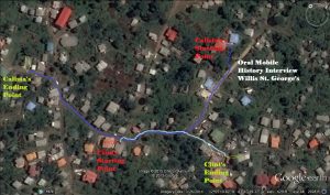
That’s how we developed the idea of mobile oral histories as a way to capture perceptions of the landscape that were widely shared by community members but rarely written down. Of course, the methodology of “walking interviews” has been used by urban planners for decades, as a means of understanding the perceptions of place held local residents as a tool in the formulation of development plans. But we were not looking to build roads or situate housing projects. Our goal was to encourage local communities to cherish and protect their own memories and values about the landscapes they lived in, even if their particularly town or village was not on the “official” heritage list. So along with other participatory ethnographic methods—like focus groups and photovoice programs—that we used to elicit heritage values and identify all kinds of local heritage resources, we began to recruit two-person mobile oral history teams to interview people of all ages, walking with them through the landscapes of our first project locale, on the island of Grenada and its smaller federal partner to the north, Carriacou.
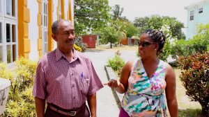
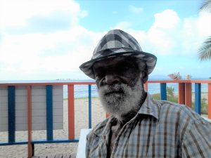
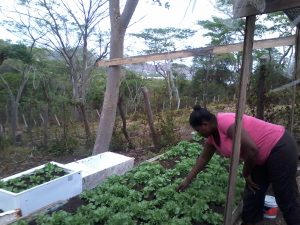
The results were quite amazing in the unexpected insights that they revealed. With one of the mobile oral history team conducting the interview with a small hand-held recorder (later we simply used smartphones) and the other taking notes and sketching out a map of the walking route, we found that a mix of personalities and generations yielded some colorful and insightful conversations about the landscapes they traversed. One of the interviewing teams was a retired church deacon and a hip hop producer. Among the subjects were a retired school principal who reconstructed the landscape of colonial schooldays, a fisherman who walked along an isolated beach where the huge seine nets were once thrown, but no longer are; a worried mother who described the geography of gang warfare in her village; and an ambitious small-scale organic farmer who envisioned how she wanted the landscape of Carriacou to become.
The beauty of the mobile oral histories, in contrast to the other standard oral histories I had done, was that the interviewee was not restricted to answering prepared questions, but was also encouraged to bring up subjects, memories, and associations as they walked along. The later replacement of handheld recorders by the interviewers’ own smartphones loaded with free apps that allow georeferencing, photos, videos, and sound recording provided an affordable suite of tools for every team.
After Grenada, we repeated the mobile oral history studies of the landscape in Guyana, Jamaica, and St. Lucia with equally rich results. They proved to be a kind of collective self-ethnography that not only documented local landscape perceptions, but also encouraged lively discussions about the landscape elements that each community cherished and did not want to lose. This local sense of place is obviously just as important as the tourist and protected landscape perspectives, for it can document the vision and values that the local residents deeply identify as their own.
For more information on this project, see http://coherit.com/projects/oas.html
The author of this post Neil Silberman is the founding president of the ICOMOS International Committee on the Interpretation and Presentation of Cultural Sites. He is now a partner in Coherit Associates, an international heritage consultancy that specializes in community engagement.